
Stone and Sea – The Thracian Trail
patterns across more than a millenium

patterns across more than a millenium
On terra, we follow patterns and trails of memory and matter – stone walls safeguarding lives and voices far older than our own. In the summer of 2025, Bulgaria opened such a passage: a surf across UNESCO sites, under the eternal watch of the Black Sea. Here, multiple thresholds were revealed – chapels carved in rock, Thracian tombs sealed since the Bronze Age, a queen’s seaside refuge, and a ferry cruising into dusk.
This loop spanned more than a millennium of history: from hermit Orthodox monks chiseling faith into stone, to Arbanassi’s quaint vibe, from Kazanlak’s eternal riders to Queen Marie’s Balchik gardens and the silent guardians of Sveshtari. Each doorway revealed a fragment of how this land remembers itself – and how I now carry it in my own memory.
Follow me, as I’m southbound again. If you want to feel the weight of stone and the salt of the sea, come along.
1.1) Origins in the Cliffs
Our journey begins with the first threshold, which dates back to the 1220s – when a handful of monks left the crowded heart of Tarnovo and walked north, following the bends of the Rusenski Lom until the river pressed against walls of limestone. Here, far from noise, they began carving shelters into the cliff: narrow cells, small chapels, steep steps that clung to the rock. For the monks it was an exodus – every mile away from the capital pulled them deeper into silence, until only stone, water, and prayer remained.
Video: Threshold Entry Point #1 – Aerial journey to Ivanovo’s Rock-Hewn Churches, via Google Earth (2025).

Image: Portrait of Tsar Ivan Assen II from G. Danchoff.
1.2) Patronage and Preservation
Tsar Ivan Asen II gave his blessing, and a century later Tsar Ivan Alexander enriched the work with land, icons, painted saints. The rulers’ donations – land, icons, painted programs – gave the site prestige, while the cliffs themselves gave the monks seclusion, their chambers accessible only by rough-hewn paths and vertiginous ledges.
Many centuries-old inscriptions persist, including the carved signature of the monk Ivo Gramatik (1308-1309). Their monastic community bloomed through the Second Bulgarian Empire, painting frescoes in the 13th-14th centuries, and persisting, in slow decay, into Ottoman times.
In 1979, UNESCO inscribed it as a World Heritage site. In modern times, efforts have focused on research, consolidation, and hydro-isolation of the rock mass to slow the erosion so that color, halos, and prayers may continue to survive on the cliff walls.
As you can see, the Second Bulgarian Empire under Tsar Ivan Asen II stretched from the Adriatic to the Black Sea, reaching as far north as Belgrade. The solid yellow areas mark the empire’s core territories, while the hatched regions show vassal states – lands that acknowledged Bulgarian rule after the victory at Klokotnitsa (1230). This was the golden arc of medieval Bulgaria: a crossroads of trade, language, and Eastern Orthodox faith, when art and devotion were carved into stone – and outlived the empires that followed.
1.3) Rock-Hewn Churches Today
You’ll see the valley tightening and the cliffs appearing on the horizon. The threshold point #1 from the video drops you right there, on the photo with the souvenir shop. It’s also the farthest you can drive. From here, it’s a hike – a short one though, no worries.
The final traces of modern commerce.
One with nature
You have two options: either ascend the rock-carved steps or follow the Gramovetz Eco-Trail. As we’ve grown accustomed to on terra, the call of the land is hard to ignore, so I took the trail. It winds through dense forest and along riverbeds, beneath the tall limestone cliffs of Rusenski Lom Nature Park. The full route stretches far beyond, but here we follow only the path to the churches – about a 30- to 40-minute climb.
High above the Rusenski Lom valley – the Gramovetz Eco-Trail climbs toward the limestone ridge where the monks lived. Several rare bird species, such as the Egyptian Vulture and the Golden Eagle, can be found in this valley, if you are lucky enough to spot them.
After the hike, the path narrows and leads you straight to the edge of the cliffs. The stone carvings begin to appear here – quiet hollows shaped by human hands seven centuries ago. These first chambers were likely the monks’ resting places, cut directly into the limestone and left bare. The walls still bear tool marks, soft ripples where picks met stone, and traces of soot from the oil lamps that once flickered here.
A small sign explains their purpose: rock-hewn premises – early dwellings, storage spaces, or meditation cells connected by steps and ledges. Standing there, you feel how the landscape itself became their monastery. How nature was, for sure, part of their prayer, with the cliff being a living proof of devotion and endurance.
The entrance to the Church of the Holy Virgin – the only one open to visitors – is narrow and hidden between two slabs of rock, a passage so discreet that it may have helped the chapel survive untouched through centuries of wind and wars. Among the beautifully painted frescoes, a Last Supper unfolds across the wall, created more than a hundred years before the famous versions by the great Italian masters. Here, the apostles dine in silence under a vaulted cave ceiling, their faces lit by ochre and lime, not by Renaissance grandeur.
When you step back into daylight, the valley seems louder than before. The road calls, stretching south once again. For a few moments, the mind lingers between centuries – from monks who carved silence, through Ottoman occupation, to modern times. Then the engine starts, dust rises, and the trail bends toward Arbanassi.
2.1) Entry – The Hill Above the ex-Capital
Our journey continues with the second threshold: the plateau village of Arbanasi, a few kilometers above Veliko Tarnovo. I reached Tarnovo after hours – summer schedules shuttered, museums dark – so I kept the engine on and climbed the last bends to the ridge.
Up here, the air changes. Thick and tall stone fences run like castle walls and courtyards hide behind heavy gates. It feels less like arriving in a village and more like stepping through a side door of history – rich, quiet, intact, ready to be walked at the pace of footsteps. It was time for exploring.
Video: Threshold Entry Point #2 – Aerial journey to Arbanasi, via Google Earth (2025).

Image: Portrait of Suleiman the Magnificent by Nakkaş Osman (Topkapı Palace, MS Hazine 1563, fol. 47v).
2.2) History
A merchant village from the late 16th – 17th centuries, Arbanasi grew rich at the doorstep of the old capital. Wealthy merchants built high stone walls, whitewashed houses with sturdy roofs, and churches packed with full fresco cycles and carved iconostases – a compact hilltop economy facing Tarnovo and the trade routes beyond.
The earliest firm record is a 1538 decree by Sultan Suleiman the Magnificent granting the lands of Arbanasi, Lyaskovets, Gorna Oryahovitsa, and Dolna Oryahovitsa to his son-in-law, Grand Vizier Rüstem Pasha. In that document the four are called “Arnaud Kariyeleri” – the Albanian villages – and early settlers likely came from Epirus/Albania, though Orthodox Slavic names soon predominate in tax registers. By 1579 – 1580 the place had quadrupled in households, staying entirely Christian and heading into its 17th-century boom.
Under the Ottoman system, local Orthodoxy was under the Ecumenical Patriarchate; Arbanasi had Greek-language liturgy and a Greek school for centuries, even as its residents remained part of the Bulgarian Orthodox milieu and merchant networks across Transylvania, the Danubian Principalities, Russia, and Poland.
As you can see here, in the 16th-17th centuries the Ottoman Empire dominated the Balkans and the eastern Mediterranean. Rumelia (the empire’s European wing) included today’s Bulgaria, while Wallachia, Moldavia, Transylvania, and the Crimean Khanate stood as vassal states around it. Arbanasi sat just above Veliko Tarnovo on the road web between Danube crossings and the Balkan passes – an imperial framework of taxes, safe routes, and markets that let a small hill village fund thick-walled houses and richly painted churches. A 19th-century scholarly tradition ties Arbanasi to Bulgarian boyars resettled after Ivan Asen II’s 1230 victory at Klokotnitsa – when he took “the land of the Albanians.”
2.3) Arbanasi – today
I reached Veliko Tarnovo’s old town after closing – think summer break, businesses closed, no skiing (Yes, there is a ski place in Veliko Tarnovo) – so I pushed a few kilometers up the plateau to Arbanasi instead. Better choice for the day’s light: calm streets, open courtyards, and time to walk. As soon as Veliko Tarnovo ends, the medieval fortress Tsarevets reveals itself in all its glory. Unfortunately, it was closed too, so I skipped it.
Next stop? Arbanassi. Once the village opens, if you bat your eyes twice (not recommended while driving), you’ll already be out of a small, quaint village, kept in a pristine state. You’ll feel like going back in time, in a low-pop, summer-holiday, welcoming village.
It’s a protected architectural reserve with five churches – Nativity (oldest), Sts. Archangels Michael & Gabriel (largest), St. George, St. Demetrius, and St. Athanasius – and two monasteries: Dormition (Holy Mother of God) and St. Nicholas. As of 2025, Arbanasi isn’t a UNESCO World Heritage site, but it’s often proposed and promoted alongside Tarnovo’s medieval ensemble; parts have been discussed for Tentative List submissions. Below is a gallery of the Orthodox sanctuaries.
After all of this religious discovery, I needed a break. So I’ve started wandering the streets during golden hour and in the evening. Tiled roofs, inward-facing houses, stone lanes and small business held the village’s slow rhythm.
I booked one night at the Izvora🔗, which felt like being in an early 20th-century lodge (great location, staff so-so – always the card payment… always). Anyway, I left my stuff and took some pictures of the village.
While wandering through the village, I stumbled upon an open courtyard where a group of mixed children and teens were preparing for a TV recording. The screams of the music teacher, louder than the singing, could be instantly decoded (even if I don’t know Bulgarian, I could understand it) – “Cut! Stop the music! Louder, louder! Come on, boy, like you did at rehearsal!“.
The camera crew had heavy gear set up, and the air carried that mix of nerves before a performance. The kids, dressed in vivid traditional garments, began singing. While I was watching them, my Romanian soul couldn’t help but notice how familiar it all felt – the colors, the vibes, the warmth. We’re closer than we think.
She was pushing for a single, perfect take. It felt intense for the kids, especially under the summer sun, when most would rather be anywhere else but performing in traditional garment.
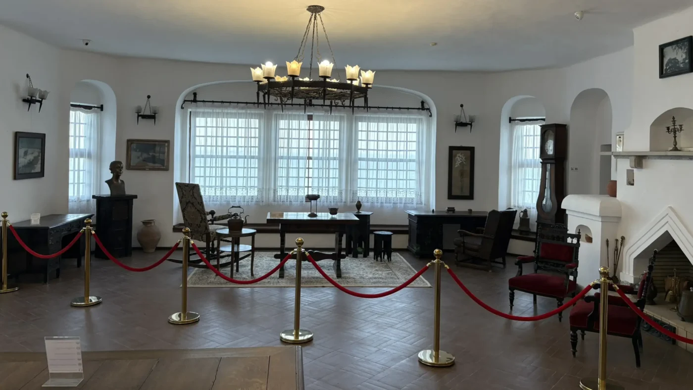
Behind a high stone wall, the Konstantsaliev House keeps the memory of a merchant’s fortress: two stories of timber and lime, a heavy gate where caravans once entered. Built at the end of the 17th century (first owned by the Tafrili family, later by Atanas Konstantsaliata, from whom it takes its name), it now holds an ethnographic museum showing the comforts of Arbanassi’s trading zenith – huge divans and kilims, wood-carved sliding! shutters, family rooms, summer and winter salons.
I want to thank you for reading so far – I have two bonus videos for you.
Next morning, I grabbed some souvenirs from the Konstantsaliev House, where a lady was selling homemade soap bars – loved the small business vibe – and immediately left for Kazanlak and Balchik. A long day was on the horizon.
i.1) Approach – The Cliff-Split Road
Southbound yet again, the road drops through a limestone cut and slips into the Rose Valley. It’s one of those Balkan stretches where rock presses close and the sky feels narrow for a minute – then it opens and you’re in Kazanlak all of a sudden.
i.2) Objective
Clock was ticking – and on terra, we respect the speed limits and there shouldn’t be any rush after all, right? Well, this time I really needed to backtrack all the way to Balchik, on the same day – during daylight. So, to save time, I skipped the city this round and aimed directly for the Kazanlak Thracian Tomb.
And so, as it was foretold, my one-day journey spanned from Arbanasi, then down to Kazanlak and finally, The Black Sea. It doesn’t sound THAT bad, but take into account some bumpy roads, Bulgaria’s offensive speed limits AND have time to check out the first Thracian Tomb of the trip? Fortunately, I managed to do it all, without fines.
It’s the last time I mention the speed limits, because I don’t wanna anger anyone, but, I see myself in a TV commercial spot: “You have problems speeding on the highway? You fear that this trip might be your last? We’ve got the solution! – Drive in Bulgaria, today! If you exceed the speed by 5 km/h, you’ll automatically get fined, over and over – for the each segment of the road you get caught on.“
Anyway, where we were? The Thracian Tomb of Kazanlak.
i.3) What it is (and who lies here)
The Thracian Tomb of Kazanlak was found by chance in 1944 during wartime trenching. It’s a Late 4th – early 3rd-century BC tomb, part of a royal necropolis near Seuthopolis, capital of Seuthes III. The murals-funeral feast, chariots, horse teams – are among Bulgaria’s best-preserved Hellenistic paintings.
Scholars read the burial as that of a Thracian aristocrat (likely a couple); exact names are unknown. The paintings reflect the couple’s struggles until their death. Today the mound sits inside Tyulbe Park, a short walk from town. It is inscribed by UNESCO as a World Heritage site in 1979. Below you will find a gallery with pictures from the original place – currently closed for tourists for research (a 1:1 replica is nearby – 2 min walk). Look at how good it was preserved.
i.4) Access & the replica
The original chamber is periodically closed for research/conservation. To protect the paintings, a full-size 1:1 replica was built in 1973-1974, designed by architect Mladen Panchev; the frescoes were recreated by Prof. Lyuben Prashkov, Zlatka Kozhuharova, and Slavi Voykov. That’s the one you can enter next to the real mound.
i.5) Back on the road
About an hour later I was buckled in and pointing east to Balchik. Bulgarian roads can be patchy – especially if your navi drags you off the main arteries – so check suspension/tires and be ready for 500 kilometers of mixed surfaces. Have your mechanic promise you that the wagon will last, or do a quick tires-suspension-fluids check. Between towns there’s fields and orchards, with cooling patches of forest breaking the heat. Lesson learned: Prefer national/E routes, have offline navi.

1.1) Entry
Part Two opens with a descent to the sea. After hours of fields and low hills, the road descends toward chalk-white cliffs and the first breath of salt. At Threshold Entry Point #3, Balchik appears at once – terraces, tiled roofs, under the eternal watch of the Black Sea.
I reached the threshold at around 16:00. Reset came fast: a cold Tarator and a small Zagorka, swimwear change in the car (as I didn’t check-in yet) and shoved myself straight into the Black Sea – I needed a one-to-one.
Video: Threshold Entry Point #3 – Aerial journey to Balchik, via Google Earth (2025).

Image: Portrait Queen Marie of Edinburgh.
1.2) History
In ancient times, on this shore, the town was known as Krounoi / Cruni and later Dionysopolis, a Greek-Thracian port famed today for the excavated Temple of Cybele under the old quarter.
Under Ottoman rule, as part of Rumelia, Balchik lived as a small Black Sea port in a multi-ethnic landscape, its Orthodox life organized through the Ecumenical Patriarchate and its trade tied to Danube – Aegean routes.
After the Second Balkan War (1913), Southern Dobruja (including Balchik) entered Romania and stayed so until 1940, when it returned to Bulgaria by the Treaty of Craiova – a settlement concluded under German-Italian pressure following Hitler’s indication that the 1912 border be restored; the treaty also mandated a population exchange.
During the reign of King Ferdinand I, Romania’s queen consort Marie of Edinburgh visited Balchik in the 1920s and instantly fell for the chalk cliffs and salty air; she later wrote:
“…as if this place had always been waiting for me.“
She commissioned the Quiet Nest seaside residence with the Stella Maris chapel and terraced gardens – built 1926-1937 by Italian architects Amerigo and Augustino – a complex whose minaret-like tower and Orthodox chapel mirror her broad spiritual sympathies.
As you can see here, during the interwar period (1913-1940), Southern Dobruja, including Balchik (marked in red), was part of Romania, forming the country’s southeastern edge – a short-lived frontier – before the region’s peaceful return to Bulgaria through the Treaty of Craiova in 1940.
After 1940, the residence became Bulgarian; the University Botanic Garden (Sofia University) was established on the site in 1955 and now holds one of Europe’s notable open-air cactus collections; the whole ensemble is a protected national cultural site and part of Bulgaria’s “100 Tourist Sites” list.
1.3) Balchik – today
Practical access:
– Two tickets, two gates. The Palace (Quiet Nest) and the University Botanic Garden are ticketed separately. If you exit one compound to enter the other from the outside gate, you’ll be asked to pay again. Either do both in one go via the internal connector, or buy/visit them separately.
– Bring cash. As of 2025, the staff does not accept payment by card.
Queen Marie’s retreat is a hybrid of Balkan vernacular, Mediterranean patios, and a minaret-like tower that catches the skyline. Inside it’s white plaster, wood, and filtered light for max serenity. The complex includes the Stella Maris chapel (where her heart once rested), waterside paths, small courtyards, and a scatter of personal symbols – crosses, a stone “throne,” ceramics – showing her broad taste and spiritual openness.
Managed today by Sofia University as the University Botanic Garden, the terraces stitch together Mediterranean beds, shaded pergolas, old stone paths, rose parcels, and a noted open-air succulent collection. It’s less a single “park” than a sequence: high gate – pergolas and vistas – rose gardens – sea-edge lanes. Plan at least an hour if you like plants; more if you photograph details. Mid-afternoon is bright; late light (golden hour) is best for photos and cooler walking – just be mindful of the closing hours.
Curiously, few mentions remain of Queen Marie – the Romanian monarch whose vision shaped every path and terrace here. History, it seems, is sometimes edited for simplicity.
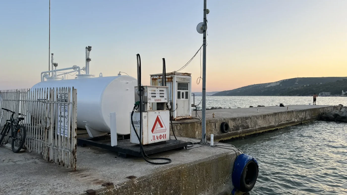
Loved it. Balchik meets you with a terra-styled (honest, balanced, deep) human scale: a working dock, small restaurants layered on terraces, and ten times the people compared to Arbanasi – plus a small army of cats.
Here’s the thing though: It should feel loud – it doesn’t. The sea absorbs sound, the boardwalk slope and break it, and most evenings are conversation-level calm. You walk, you sit, you watch boats park. It’s calm and friendly without insisting on it.
I lingered by the dock longer than planned – it reminded me of my late dad. He was a licensed skipper, passionate about boats. The vibe had that early-summer heft where noise softens and thoughts sharpen.
Watching the boats drift, I couldn’t help but feel a small disappointment – that back home, we never quite managed to shape a seaside town with this kind of balance. “Politics? Education?” I wondered. Ah, nevermind. Balchik breathes deeply – humble, unforced, and genuinely restful. No excess, no noise pretending to be joy. Just the rhythm of water against hulls, and the quiet company of one’s own thoughts – which – for once, they arranged themselves (a rare occurence).
I walked the boardwalk alone late into the evening, when the cafes had dimmed and the sea was whispering under the lamps. The crickets were louder than people. It’s the kind of soundscape that resets you – I found myself wishing I didn’t have to leave in the morning.
Balchik’s shore is more stone than sand. You’ll find small sandy pockets, but most access is by steps and platforms that drop you straight into clear water beside the breakwaters.
Bring water shoes to prevent an accidental slip. It’s less about sprawling on a beach and more about slipping into the sea, floating, then drying out. I enjoyed not having my feet and my body stuck with sand specks, no joke.
The sea moves in slow folds around these parts. It’s much calmer than, say… Vama Veche, where I had the greatest times of my life (read the full story here🔗). I took advantage of the calmer Black Sea and I wasted several hours, fully immersed, swimming and relaxing. I slipped past the stone steps and into the water, and that’s where I found him – a tiny hermit crab carrying his own fortress. I took a few photos, then let him drift back into the tide.
The Black Sea speaks the same language no matter the border. Take me to the sea in summer, and I’ll prove that life is still worth living. I’ll prove that no matter our origin or mindset, we can all get along. Anyway, I got lucky this time – mid-June usually means storms and colder-than-normal weather, yet the water was warm, the waves polite, the air clear enough to make you forget the world inland.
Thanks for reading this far – consider this your well-earned reward. Balchik was overflowing with cats, lounging on walls, docks, and cafe steps. There were many more than these few, but some escaped my lens… or maybe I was just too distracted by the sea, the lights, or the moment itself.
I’ve mentioned Vama Veche🔗 earlier, because it’s part of what I was thinking about while standing on this above-sea cafe at dusk – wooden boards held by steel pillars, a Diet Coke sweating on the table, and the sea murmuring below. Man, how the years have passed. Ten years ago, by this hour, I’d have been out on the sand, chasing the next beach party, chasing noise, chasing youth. Now? All I want is stillness, peace of mind, reflection, wisdom.
After this trip through the centuries – Thracian nobles, carving monks, wars, queens – I just stood there, realizing how short a human lifetime really is. Our history is a blink in the universe, yet somehow, it blinked us into being here, now. It’s strange: we walk through ruins and gardens, but what we’re really tracing is meaning, rememberance, perhaps leaving something behind. I always tell my peers that we need to think about the bigger picture more often. Maybe that’s what places like Balchik are for – it widens the frame, gently, until the horizon feels like an answer.
I stayed in Balchik for four nights, sincerely wished for more. I’ll return next summer for a longer stay. I asked the staff of Hotel Regina Maria🔗 to give me some extra nights, but the joint was fully booked. Oh yeah, the place was great. Felt like I was at an all-inclusive super-expensive resort at a quarter the money. Really, really worth it.
I’ve almost completely forgot that next day I had to reach the Sveshtari Thracian Tombs AND catch a ferry ride back to motherland. The next morning I packed my stuff, took a good look at the Black Sea, some deep breaths, turned the engine on and I left west, towards my next, final destination.
2.1) Final Threshold
Once again, deep into Bulgarian fields, which grew flatter and emptier as I persevered. There was a heatwave that made the AC in my car struggle. I found a restaurant🔗 in the middle of nowhere, I think it was called Isperih. They had amazing traditional food (I even took away some dishes for home), I let the car cool down in the shade, and they even accepted payment by card! If I ever drive by, I’ll stop again for sure.
I nearly got lost after I was past the last proper town. Then, as customs in Bulgaria – Sveshtari just appeared, like a whisper: a few low hills, one of them carved into a door. This was the final threshold of the trip, a short 6-kilometre detour off the main road. The Thracian tomb felt like a place the earth had quietly kept secret.
Video: Threshold Entry Point #4 – Aerial journey to Sveshtari Thracian Tombs, via Google Earth (2025).

Image: Bust of Dromichaetes.
2.2) History
The Thracian Tomb of Sveshtari was discovered in 1982 near the ancient city of Helis, once the capital of the Getae – a Thracian tribe that flourished between the 4th and 3rd centuries BC. Built for a Getic ruler and his consort, the tomb is unique among Thracian monuments for its architectural and symbolic synthesis: Greek-inspired columns merged with indigenous beliefs about immortality.
The tomb likely belonged to a rich Getic ruler from the age of Dromichaetes – the same king-chieftain of the Geto-Dacians, ruling from Helis, who once captured Lysimachus (the successor of Alexander the Great) and, rather than killing him, released and offered him a feast – for a lesson in humility. The Thracian code was known to have “novel” elements for that time: wisdom over vengeance.
Inside the central chamber, ten female figures with raised arms – half-human, half-plant (Dryads, perhaps?) – seem to hold the stone ceiling itself. Their gestures were meant to make eternal the ruler’s ascension. Along the arch, the guide points the group to faint traces of paint – reds, blues, and ochres.
The world of the Getae, cca. 200 BC.
At their height, the Getae ruled the lower Danube basin, between the Dacians to the north and the Thracians to the south. Their lands stretched from the Carpathians to the Black Sea – a bridge between continental and maritime worlds.
During the Hellenistic period, the Getae traded and warred with Macedonians, absorbing cultural threads from both worlds. When Rome rose, their sanctuaries fell silent. What remained were mounds – hundreds of them – scattered like quiet time capsules across the plain.
In 1985, Sveshtari was inscribed as a UNESCO World Heritage Site, recognized for embodying the Thracian spiritual duality: life on earth, eternity above it.
2.3) Sveshtari – today
Access to the site is tightly controlled. Only a few groups enter each hour, led by local guides who unlock the automatic steel door beneath the mound. I recalled one of them “Seed Banks”. If you’re visiting during summer, dress up, because inside, temperature drops sharply.
HAVE CASH! As of 2025, the Sveshtari Thracian Tomb does NOT accept payment by card. I had 20 Leva left, so I got lucky, like REALLY lucky. I really didn’t enjoy this part of the trip. The guide won’t let you take photos, because the process of capturing photons with a phone camera will ruin the delicate state of the tomb – a stretch, really, I took photos anyway. There’s a gallery waiting below for you, one picture is from the web (Getae wiki page🔗), the rest are mine – quick captures so the guide wouldn’t kick me out.
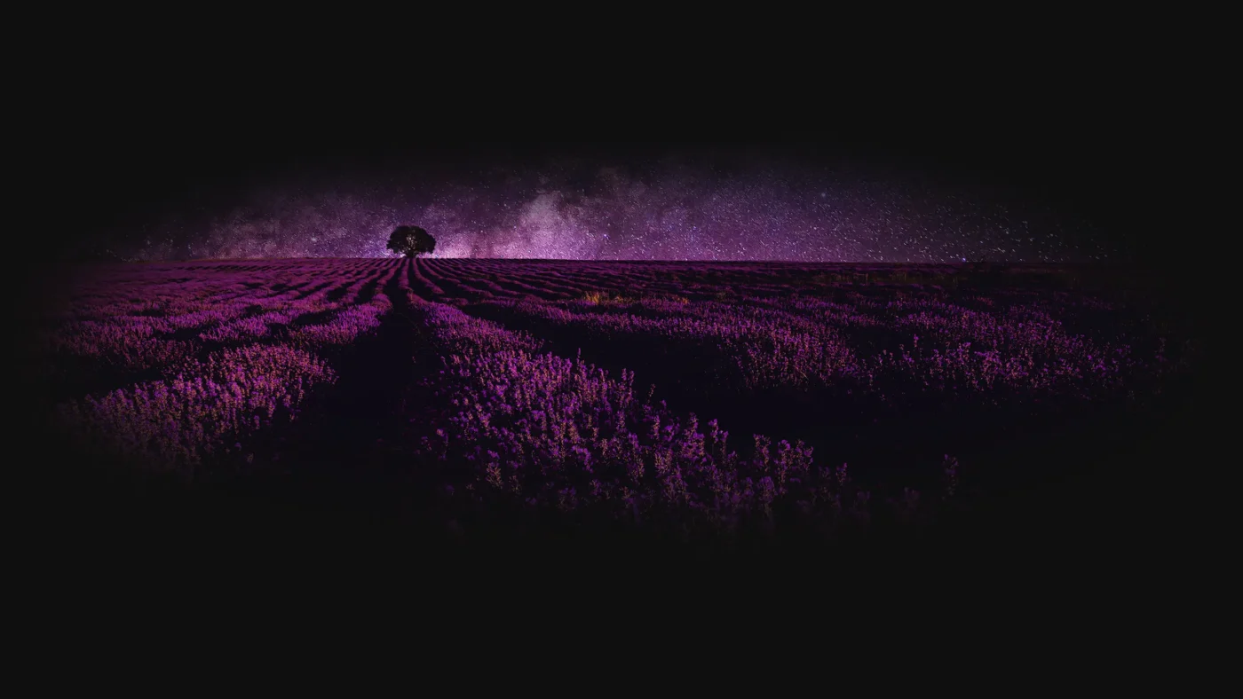
Outside, modern structures shelter nearby tombs still under research. Corrugated iron sheds, air-conditioned conservation rooms, and low paths cut through the grass. It’s not a polished tourist destination (the card thing really vexed me). Anyway, if we look on the bright side of things – it isn’t bad, really – there’s the sense that you’ve stepped into a working archaeological research site. The lavender fields nearby mix-up the colors, and somewhere beyond them, I could see farmers – stacking hay the same way our ancestors did.
I repeat myself, but I’m awed and thankful to be living on this Earth. It’s incredible how turbulent the world became once humanity entered classical antiquity – and how, through countless struggles, we’ve evolved in what is, cosmically speaking, a blink of time: from carving dryads in stone to carrying all-day long battery-powered laptops and sending probes beyond the solar system. I just wish we could all get along. Imagine what a united, planetary mind could achieve. With a smile on my face, I turned on the engine and headed home.
2.4) The Road Back Home – The Ferry
From Sveshtari I drove north, then west, through small border towns until the road concluded into the Silistra – Călărași ferry crossing. It was late afternoon; the Danube shimmered proudly. I got a ticket and waited in line (it’s quick, no worries). Seeing all those expensive cars waiting in line, most likely bought on very unfavorable credit lines – I felt a very familiar feeling, I was back home, in Romania.
A man in a worn cap was already waiting on his electric scooter. He was waiting for the ferry as if he’d done it a thousand times – and he had. A lifelong commuter between Călărași and Silistra, he spent decades crossing the Danube twice a day for work. Now retired, he still rides over every week – “Cigarettes are cheaper here” (on the Bulgarian side), he said with a half-smile. His son lives in Bucharest now and doesn’t visit much. He keeps his old Skoda in shape, hoping his son will come one day to take it – he’s been saving it for him.
That brief encounter stayed with me. Throughout this trip – from the painted churches of Ivanovo to Arbanasi’s quiet resilience, from Queen Marie’s seaside gardens in Balchik to the Thracian tombs of Kazanlak and Sveshtari – I kept thinking about how deeply our roots matter. History, faith, and love for our parents are all the same thread: they hold us steady through time, reminding us who we are and where we come from. I hope that guy will eventually come visit his father.
The Northern Bulgaria Loop – A Journey Through Stone and Sea
After my tires touched Romanian soil, I didn’t feel much difference. The roads are a bit better, and the speed limits are more relaxed – in terms of frequency of getting fined, but that’s not the point. We are the same, North, South, East or West, Bucharest, Sofia, Paris, LA, Rio, Lagos, Tokyo. My wish remains: A Planetary Mind.
Stone and sea have a way of bringing you down to the essential. This loop through Northern Bulgaria was less checklist and more calibration: monks chiseling faith at Ivanovo, Arbanasi wrapped in stone, a painted farewell in Kazanlak, Queen Marie’s terrace guarded by the Black Sea, and Sveshtari’s stone dryads. Different centuries, same message: in the short time we’re here – build something.
On the dock at Balchik I thought of my late father – at the ferry, an old man telling me his life story and his son who might come back, but doesn’t. We carry people forward by keeping things running – cars, gardens, names, memory. Maybe this is what immortal really means?
If there’s a lesson in tombs and chapels and seaside paths, it’s this: history survives because someone loved it enough to maintain it. This can scale – from a single stone piece to a city, from a family to a planet. I’ll return to Balchik for a longer stay. Until then, I’ll keep the trail warm.
I think that terra is about that kind of upkeep – of memory, of places, of the people who made us steady. May we be worthy keepers.
Stay tuned right here, on Unbound Planet.
–Theo
Contact me🔗 with your stories, tips, or memories.